Hadrian's Wall Path Map Booklet
1:25,000 OS Route Mapping
| Autor | |
| Quelle | Sonstige Datenquellen |
| ISBN | 978-1-78631-151-1 |
| Lieferbarkeit | lieferbar |
| Katalogisat | Basiskatalogisat |
| Verlag | Cicerone Press Limited |
| Erscheinungsdatum | 12.10.2023 |
Beschreibung (Langtext)
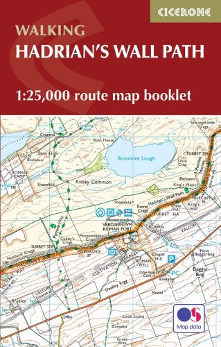
All the mapping you need to walk the Hadrian’s Wall National Trail between Bowness-on-Solway in Cumbria and Wallsend, Newcastle. Covering 135km (84 miles), this historic route takes around 10 days to hike. Suitable for beginners, it nevertheless requires a reasonable level of fitness to undertake as a multi-day walk.
The full route line is shown on
1:25,000 OS maps
The map booklet can be used to
walk the trail in either direction
Sized to easily
fit in a jacket pocket
2-stage
route extension
through Newcastle to South Shields on the east coast is also shown
A separate
Cicerone guidebook
– Walking Hadrian’s Wall Path – is also available, which includes a copy of this map booklet