Das severische Vexillationskastell Myd(---)/Gheriat el-Garbia am limes Tripolitanuns (Libyen) 1.: Forschungsgeschichte, Vermessung, Prospektionen und Funde 2009-2010 / mit Beiträgen von Agnes Dinkel, Johannes Eingartner, Ludwig Hoegner, Wolfgang Hübner, Klaus Löcker, Hans-Christoph Noeske, Florian Schimmer, Sebastian Schmid, Siri Seren, Manfred Strephani und Meike Weber
| Autor | |
| Quelle | Sonstige Datenquellen |
| ISBN | 978-3-7520-0586-8 |
| Lieferbarkeit | lieferbar |
| Katalogisat | Basiskatalogisat |
| Verlag | Reichert, L |
| Erscheinungsdatum | 11.08.2021 |
Beschreibung (Kurztext)
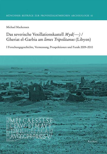
In 2009/10, four seasons were conducted in the Roman fort located 280 km south of Tripoli. The focus of the interdisciplinary project, funded by LMUexcellent, was the fort, built above an oasis for a legionary vexillation around AD 200. The garrison performed control and surveillance tasks and was responsible for the security along the caravan route to the Fezzan. The history of research in the Tripolitanian frontier zone (limes Tripolitanus) from 1819-1996, the geodetic survey of Gheriat el-Garbia and its surroundings based on radar data from the German earth observation satellite (TerraSAR-X) and the Roman surveying scheme of the fort are presented. The architectural elements provide information about the sophisticated architectural design of the Severan fort. The ceramic survey, the coins and the radiocarbon analyses (14C) provide information on the history of the fort and its occupation not only in the 3rd century, but also on the dating of the reoccupation and restoration of the fort in Late Antiquity.
In dem 280 km südlich von Tripolis gelegenen Kastell fanden 2009/10 vier Kampagnen statt. Im Mittelpunkt des interdisziplinären Projekts, gefördert von LMUexcellent, stand das oberhalb einer Oase für eine Legionsvexillation um 200 n. Chr. erbaute Kastell mit exzeptionell gut erhaltenen Wehranlagen. Die Besatzung nahm Kontroll- und Beobachtungsaufgaben wahr und sorgte für Sicherheit an der Karavanenroute in den Fezzan. Dargestellt wird die Forschungsgeschichte zum limes Tripolitanus von 1819-1996, die Vermessung von Gheriat el-Garbia und seines Umfelds mit Hilfe von Radardaten (TerraSAR-X) und die römische Vermessung des Kastells. Die Architekturglieder geben Aufschluss über die anspruchsvolle architektonische Ausstattung des severischen Kastells. Der Keramik-Survey, die Fundmünzen und die 14C-Daten liefern Aussagen zur Geschichte des Kastells und seiner Besatzung nicht nur im 3. Jh., sondern auch in der Spätantike.
Beschreibung (Langtext)
The Roman fort of Gheriat el-Garbia is located 280 km south of Tripoli in the pre-desert, above an oasis, on the central route to the land of the Garamantes. Along with Bu Ngem and Ghadames, it is the largest of the three new vexilliation forts of the limes Tripolitanus, advanced far to the south under emperor Septimius Severus. At the latest by autumn AD 201 its defences were finished by a detachment of legio III Augusta from Lambaesis. Since the English surveys (1953, 1981), the fort with its spectacularly well-preserved main gate has provided a valid basis for architectural reconstructions of 3rd century forts.
Within the framework of the interdisciplinary project of the Archaeology of the Roman Provinces at the University of Munich, funded by the Excellence Initiative, two campaigns each year were conducted in 2009 and 2010. The focus was laid on surveys and excavations within the fort, which was overbuilt by a Berber village (gates, headquarters building, barracks), and in one of the sanctuaries. In addition to scientific investigation methods (geodesy, geophysics, archaeometry, radiocarbon analyses), terrestrial 3D laser scanning was used. The ancient place-name Myd(---) is recorded on a pedestal for a statue. Surprisingly, in addition to the occupation of the fort until AD 275/280, there was a late antique reoccupation: from AD 390/400 until the middle of the 5th century, a unit of limitanei, the milites munifices, was garrisoned in the castra Madensia of the Notitia Dignitatum Occ. XXXI 30.
The first volume presents the history of research in the Tripolitanian frontier zone in north-western Libya and southern Tunisia from 1819 to 1996, as well as the location of Gheriat el-Garbia. This is followed by the geodetic recording of the topography of the fort and temple plateau based on radar data from the German earth observation satellite TerraSar-X. The focus is on the archaeological surveys: numerous architectural elements from the interior area of the fort result in seven orders of columns, which suggest a sophisticated architectural decoration of the central buildings of the fort. The extensive material from the ceramic survey provides information on the supply of the garrison with African red slip ware and cooking wares as well as with wine, olive oil and fish preserves transported in various types of amphorae. In addition, bronze small finds, coins and radiocarbon analyses are presented; the latter form the basis for dating the resto-ration of the fort between AD 390 and 425.
Das römische Kastell Gheriat el-Garbia liegt 280 km südlich von Tripolis in der steppenartigen Halbwüste, oberhalb einer Oase, an der zentralen Route ins Land der Garamanten. Es ist – neben Bu Njem und Ghadames – das größte der drei unter Kaiser Septimius Severus weit nach Süden vorgeschobenen neuen Vexillationskastelle des limes Tripolitanus. Spätestens im Herbst 201 n. Chr. wurde es von einer Abteilung der legio III Augusta aus Lambaesis fertig gestellt. Seit den englischen Surveys (1953, 1981) bietet das Kastell mit dem spektakulär gut erhaltenen Haupttor eine valide Grundlage für architektonische Rekonstruktionen von Kastellen des 3. Jahrhunderts.
Im Rahmen des interdisziplinär ausgerichteten Projekts der Provinzialrömischen Archäologie an der Universität München, gefördert von der Exzellenzinitiative, wurden 2009 und 2010 je zwei Kampagnen durchgeführt. Im Mittelpunkt standen Surveys und Ausgrabungen im von einem Berberdorf überbauten Kastell (Tore, Stabsgebäude, Mannschaftsunterkünfte) und in einem der Heiligtümer. Neben naturwissenschaftlichen Untersuchungsmethoden (Geodäsie, Geophysik, Archäometrie, 14C-Analysen) kam terrestrisches 3D-Laserscanning zum Einsatz. Überraschend war neben der bis 275/280 erfolgten Nutzung des Kastells mit dem inschriftlich überlieferten Ortsnamen Myd(---) eine spätantike Instandsetzung: Ab 390/400 wurde bis Mitte des 5. Jahrhunderts in den castra Madensia der Notitia Dignitatum Occ. XXXI 30 eine limitane Einheit, die milites munifices, stationiert.
Im ersten Band werden die Forschungsgeschichte in der tripolitanischen Grenzzone im nordwestlichen Libyen und in Südtunesien von 1819 bis 1996 sowie die Lage und Topographie von Gheriat el-Garbia dargestellt. Es folgen Beiträge zur geodätischen Erfassung der Topographie des Kastell- und des Tempelplateaus unter Verwendung von Radardaten des deutschen Erdbeobachtungssatelliten TerraSar-X. Im Mittelpunkt stehen die archäologischen Surveys: Zahlreiche Architekturglieder aus dem Kastellareal ergeben sieben Säulenordnungen, die auf eine anspruchsvolle architektonische Ausstattung der zentralen Gebäude des Kastells schließen lassen. Das umfangreiche Material des Keramik-Surveys liefert wichtige Daten zur Versorgung der Garnison mit Fein- und Kochkeramik sowie mit in Amphoren transportiertem Wein, Olivenöl und Fischkonserven. Zudem werden Metallkleinfunde, Münzen und Radiokarbonanalysen vorgelegt; letztere bilden die Basis für die Datierung der Instandsetzungen des Kastells zwischen 390 und 425.
Weitere Titel wie 'Das severische Vexillationskastell Myd(---)/Gheriat el-Garbia am limes Tripolitanuns (Libyen) 1.: Forschungsgeschichte, Vermessung, Prospektionen und Funde 2009-2010 / mit Beiträgen von Agnes Dinkel, Johannes Eingartner, Ludwig Hoegner, Wolfgang Hübner, Klaus Löcker, Hans-Christoph Noeske, Florian Schimmer, Sebastian Schmid, Siri Seren, Manfred Strephani und Meike Weber'